
Ngabet topographic map
Interactive map
Click on the map to display elevation.
About this map
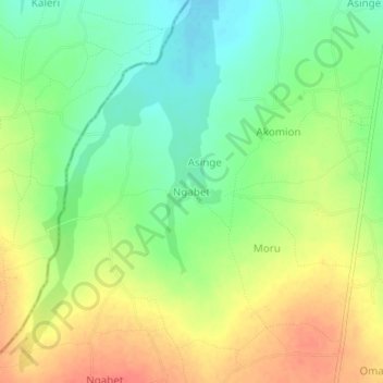
Name: Ngabet topographic map, elevation, terrain.
Location: Ngabet, Kumi, Eastern Region, Uganda (1.56024 33.87859 1.60024 33.91859)
Average elevation: 1,072 m
Minimum elevation: 1,047 m
Maximum elevation: 1,098 m