
Thank you for supporting this site ❤️
Make a donation
Make a donation
Thandalam topographic map
Click on the map to display elevation.
Thank you for supporting this site ❤️
Make a donation
Make a donation
About this map
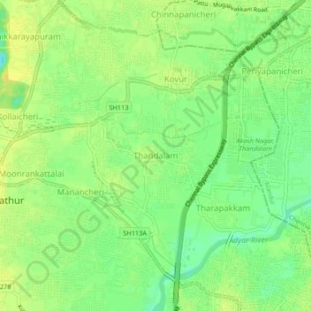
Name: Thandalam topographic map, elevation, terrain.
Location: Thandalam, Pallavaram, Chengalpattu, Tamil Nadu, 600128, India (12.98153 80.09820 13.02153 80.13820)
Average elevation: 17 m
Minimum elevation: 4 m
Maximum elevation: 25 m
Thank you for supporting this site ❤️
Make a donation
Make a donation
Other topographic maps
Click on a map to view its topography, its elevation and its terrain.
Chembrampakkam Surplus to Adayar
India > Tamil Nadu > Pallavaram > Tiruneermalai
Average elevation: 20 m
Thank you for supporting this site ❤️
Make a donation
Make a donation
Chembrampakkam Surplus to Adayar
India > Tamil Nadu > Pallavaram > Tiruneermalai
Average elevation: 20 m