
Dumaguete topographic map
Interactive map
Click on the map to display elevation.
About this map
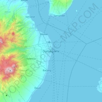
Name: Dumaguete topographic map, elevation, terrain.
Location: Dumaguete, Negros Oriental, Central Visayas, 6200, Philippinen (9.14548 123.14804 9.46548 123.46804)
Average elevation: 167 m
Minimum elevation: 0 m
Maximum elevation: 1,818 m