
Thank you for supporting this site ❤️
Make a donation
Make a donation
Harmony topographic map
Click on the map to display elevation.
Thank you for supporting this site ❤️
Make a donation
Make a donation
About this map
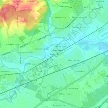
Name: Harmony topographic map, elevation, terrain.
Location: Harmony, New Castle County, Delaware, 19711, United States (39.67539 -75.71271 39.71539 -75.67271)
Average elevation: 27 m
Minimum elevation: 3 m
Maximum elevation: 85 m
Thank you for supporting this site ❤️
Make a donation
Make a donation
Other topographic maps
Click on a map to view its topography, its elevation and its terrain.
Thank you for supporting this site ❤️
Make a donation
Make a donation
Thank you for supporting this site ❤️
Make a donation
Make a donation
Bellefonte
United States > Delaware > New Castle County > Bellefonte > KynLyn Apartments
Average elevation: 35 m
Thank you for supporting this site ❤️
Make a donation
Make a donation