
Tuhovishta topographic map
Interactive map
Click on the map to display elevation.
Tuhovishta
Tuhovishta Village is located in the southwestern Rhodope Mountains and is part of the historical and geographical area Chech. t is located about 2 kilometers from the border with Greece. Altitude of the village is 700–999 meters and the area of the land is 17.15 km2. The village adjoins the lands of the following villages: in the east with Greece's border, with the lands of depopulated villages of Boren and Manastir, in the west with the lands of Slashten and Valkosel, in the south with the land of Godeshevo and in the North with Zhizhevo's land. The village is located 20 km south of Satovcha.
About this map
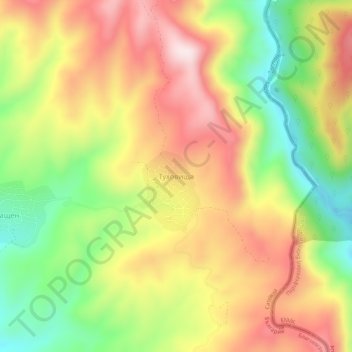
Name: Tuhovishta topographic map, elevation, terrain.
Location: Tuhovishta, Satovcha, Blagoevgrad, 2939, Bulgaria (41.48165 24.02596 41.52165 24.06596)
Average elevation: 765 m
Minimum elevation: 525 m
Maximum elevation: 995 m