
Thank you for supporting this site ❤️
Make a donation
Make a donation
Segura topographic map
Click on the map to display elevation.
Thank you for supporting this site ❤️
Make a donation
Make a donation
About this map
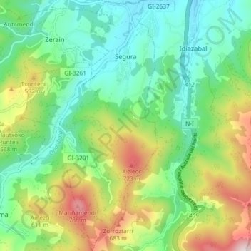
Name: Segura topographic map, elevation, terrain.
Location: Segura, Gipuzkoa, Comunidade Autónoma do País Basco, Espanha (42.96801 -2.28233 43.02074 -2.24386)
Average elevation: 410 m
Minimum elevation: 192 m
Maximum elevation: 859 m
Thank you for supporting this site ❤️
Make a donation
Make a donation
Other topographic maps
Click on a map to view its topography, its elevation and its terrain.