
Haring topographic map
Interactive map
Click on the map to display elevation.
About this map
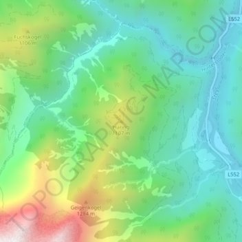
Name: Haring topographic map, elevation, terrain.
Location: Haring, Hinterstoder, Bezirk Kirchdorf, 4573, Oostenrijk (47.75073 14.14804 47.75083 14.14814)
Average elevation: 816 m
Minimum elevation: 480 m
Maximum elevation: 1,580 m