
Thank you for supporting this site ❤️
Make a donation
Make a donation
Seefeld in Tirol topographic map
Click on the map to display elevation.
Thank you for supporting this site ❤️
Make a donation
Make a donation
About this map
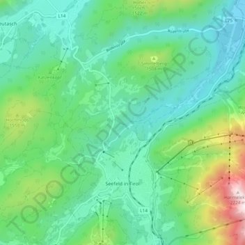
Name: Seefeld in Tirol topographic map, elevation, terrain.
Location: Seefeld in Tirol, Bezirk Innsbruck-Land, 6100, Austria (47.31939 11.16352 47.37000 11.25692)
Average elevation: 1,303 m
Minimum elevation: 1,004 m
Maximum elevation: 2,236 m
Thank you for supporting this site ❤️
Make a donation
Make a donation