
Roquetaillade topographic map
Interactive map
Click on the map to display elevation.
About this map
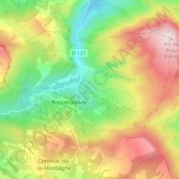
Name: Roquetaillade topographic map, elevation, terrain.
Average elevation: 423 m
Minimum elevation: 226 m
Maximum elevation: 653 m
Other topographic maps
Click on a map to view its topography, its elevation and its terrain.
Conilhac-de-la-Montagne
France > Occitanie > Aude > Roquetaillade-et-Conilhac
Conilhac-de-la-Montagne, Roquetaillade-et-Conilhac, Limoux, Aude, Occitanie, France métropolitaine, 11190, France
Average elevation: 423 m