
Ronheuville topographic map
Interactive map
Click on the map to display elevation.
About this map
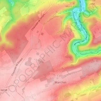
Name: Ronheuville topographic map, elevation, terrain.
Location: Ronheuville, Marchin, Huy, Liège, Wallonie, 4570, Belgique (50.47286 5.20024 50.51286 5.24024)
Average elevation: 212 m
Minimum elevation: 77 m
Maximum elevation: 266 m
Other topographic maps
Click on a map to view its topography, its elevation and its terrain.