
Сая topographic map
Interactive map
Click on the map to display elevation.
About this map
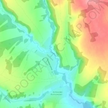
Name: Сая topographic map, elevation, terrain.
Average elevation: 188 m
Minimum elevation: 145 m
Maximum elevation: 248 m
Other topographic maps
Click on a map to view its topography, its elevation and its terrain.
Сая
Russia > Perm Krai > Дубовское сельское поселение
Сая, Дубовское сельское поселение, Beryozovsky District, Perm Krai, Volga Federal District, Russia
Average elevation: 209 m