
Mudivedu topographic map
Interactive map
Click on the map to display elevation.
About this map
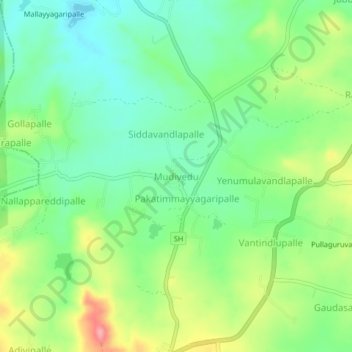
Name: Mudivedu topographic map, elevation, terrain.
Location: Mudivedu, Chittoor, Andhra Pradesh, 517353, India (13.68854 78.48696 13.72854 78.52696)
Average elevation: 663 m
Minimum elevation: 621 m
Maximum elevation: 736 m