
Thank you for supporting this site ❤️
Make a donation
Make a donation
Grottole topographic map
Click on the map to display elevation.
Thank you for supporting this site ❤️
Make a donation
Make a donation
Grottole
As with most old towns of the area, Grottole was strategically built on a mountain, standing 481 meters above sea level. At this altitude, the town was less susceptible to attack and also insects.
Thank you for supporting this site ❤️
Make a donation
Make a donation
About this map
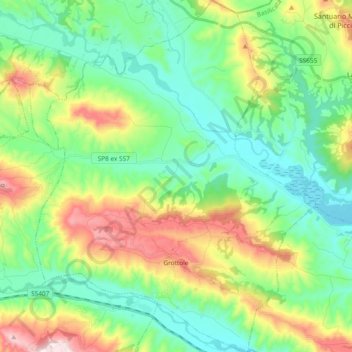
Name: Grottole topographic map, elevation, terrain.
Location: Grottole, Matera, Basilicata, Italy (40.56507 16.30660 40.70714 16.45596)
Average elevation: 250 m
Minimum elevation: 95 m
Maximum elevation: 596 m
Thank you for supporting this site ❤️
Make a donation
Make a donation