
Thank you for supporting this site ❤️
Make a donation
Make a donation
Rothenbuch topographic map
Click on the map to display elevation.
Thank you for supporting this site ❤️
Make a donation
Make a donation
About this map
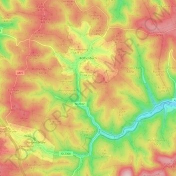
Name: Rothenbuch topographic map, elevation, terrain.
Location: Rothenbuch, Landkreis Aschaffenburg, Baviera, 63860, Alemania (49.92716 9.37612 49.98146 9.48621)
Average elevation: 409 m
Minimum elevation: 248 m
Maximum elevation: 541 m
Thank you for supporting this site ❤️
Make a donation
Make a donation