
Cabrero topographic map
Interactive map
Click on the map to display elevation.
About this map
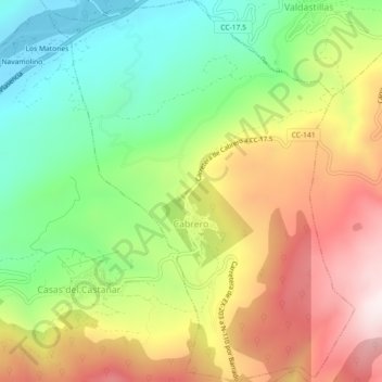
Name: Cabrero topographic map, elevation, terrain.
Location: Cabrero, Valle del Jerte, Cáceres, Extremadura, España (40.09891 -5.91007 40.13345 -5.87368)
Average elevation: 703 m
Minimum elevation: 391 m
Maximum elevation: 1,090 m