
Thank you for supporting this site ❤️
Make a donation
Make a donation
Orfordville topographic map
Click on the map to display elevation.
Thank you for supporting this site ❤️
Make a donation
Make a donation
Orfordville
Orfordville is located at 42°37′45″N 89°15′24″W / 42.62917°N 89.25667°W / 42.62917; -89.25667 (42.629300, −89.256755). The elevation is 889 feet (271 m).
Thank you for supporting this site ❤️
Make a donation
Make a donation
About this map
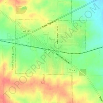
Name: Orfordville topographic map, elevation, terrain.
Location: Orfordville, Rock County, Wisconsin, 53576, United States (42.61940 -89.26868 42.63618 -89.24351)
Average elevation: 279 m
Minimum elevation: 248 m
Maximum elevation: 309 m
Thank you for supporting this site ❤️
Make a donation
Make a donation
Other topographic maps
Click on a map to view its topography, its elevation and its terrain.