
Kadugannawa topographic map
Interactive map
Click on the map to display elevation.
About this map
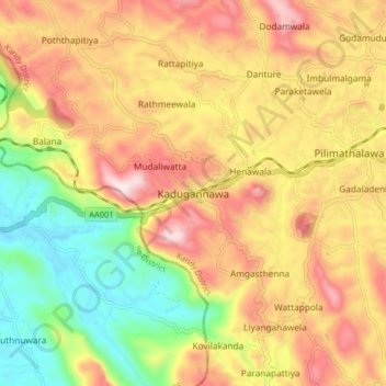
Name: Kadugannawa topographic map, elevation, terrain.
Location: Kadugannawa, Kandy District, Central Province, 20300, Sri Lanka (7.21728 80.47952 7.29728 80.55952)
Average elevation: 490 m
Minimum elevation: 210 m
Maximum elevation: 759 m
Other topographic maps
Click on a map to view its topography, its elevation and its terrain.
upper division, north meddecombra
Sri Lanka > Central Province > upper division, north meddecombra
Average elevation: 1,268 m