
Märjelensee topographic map
Interactive map
Click on the map to display elevation.
About this map
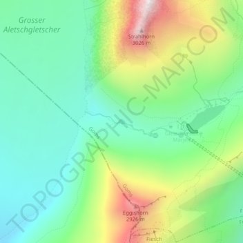
Name: Märjelensee topographic map, elevation, terrain.
Average elevation: 2,457 m
Minimum elevation: 2,171 m
Maximum elevation: 3,029 m
Other topographic maps
Click on a map to view its topography, its elevation and its terrain.
Grosser Aletschgletscher
Schweiz > Wallis > Bettmeralp
Grosser Aletschgletscher, Riederalp - Märjelensee, Bettmeralp, Östlich Raron, Wallis, 3984, Schweiz
Average elevation: 2,511 m