
Thank you for supporting this site ❤️
Make a donation
Make a donation
Frogville topographic map
Click on the map to display elevation.
Thank you for supporting this site ❤️
Make a donation
Make a donation
About this map
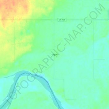
Name: Frogville topographic map, elevation, terrain.
Location: Frogville, Choctaw County, Oklahoma, United States (33.87761 -95.33273 33.91761 -95.29273)
Average elevation: 124 m
Minimum elevation: 110 m
Maximum elevation: 150 m
Thank you for supporting this site ❤️
Make a donation
Make a donation
Other topographic maps
Click on a map to view its topography, its elevation and its terrain.