
Thank you for supporting this site ❤️
Make a donation
Make a donation
Sattenapalle topographic map
Click on the map to display elevation.
Thank you for supporting this site ❤️
Make a donation
Make a donation
About this map
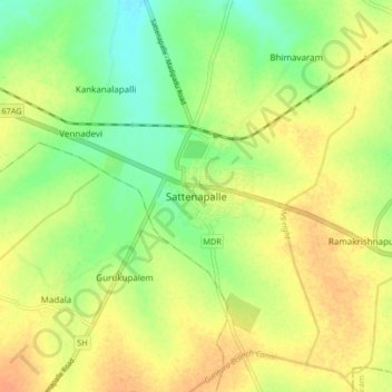
Name: Sattenapalle topographic map, elevation, terrain.
Location: Sattenapalle, Palnadu District, Andhra Pradesh, 522400, India (16.35254 80.10893 16.43254 80.18893)
Average elevation: 74 m
Minimum elevation: 54 m
Maximum elevation: 90 m
Thank you for supporting this site ❤️
Make a donation
Make a donation