
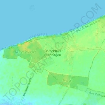
Nienhagen topographic map
Interactive map
Click on the map to display elevation.
About this map
Name: Nienhagen topographic map, elevation, terrain.
Average elevation: 6 m
Minimum elevation: -1 m
Maximum elevation: 21 m
Other topographic maps
Click on a map to view its topography, its elevation and its terrain.
Lalendorf
Deutschland > Mecklenburg-Vorpommern > Landkreis Rostock
Lalendorf, Krakow am See, Landkreis Rostock, Mecklenburg-Vorpommern, 18279, Deutschland
Average elevation: 47 m
Dobbin-Linstow
Deutschland > Mecklenburg-Vorpommern > Landkreis Rostock
Dobbin-Linstow, Krakow am See, Landkreis Rostock, Mecklenburg-Vorpommern, Deutschland
Average elevation: 64 m