
Thank you for supporting this site ❤️
Make a donation
Make a donation
Steamboat topographic map
Click on the map to display elevation.
Thank you for supporting this site ❤️
Make a donation
Make a donation
About this map
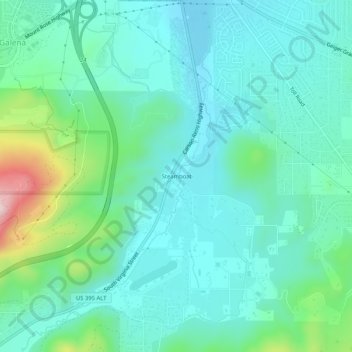
Name: Steamboat topographic map, elevation, terrain.
Location: Steamboat, Washoe County, Nevada, 89521, United States (39.35713 -119.76382 39.39713 -119.72382)
Average elevation: 1,464 m
Minimum elevation: 1,386 m
Maximum elevation: 1,761 m
Thank you for supporting this site ❤️
Make a donation
Make a donation
Other topographic maps
Click on a map to view its topography, its elevation and its terrain.
Thank you for supporting this site ❤️
Make a donation
Make a donation
Sand Harbor
United States > Nevada > Washoe County > Incline Village-Crystal Bay
Average elevation: 2,006 m
Thank you for supporting this site ❤️
Make a donation
Make a donation