
Kalterherberg topographic map
Interactive map
Click on the map to display elevation.
About this map
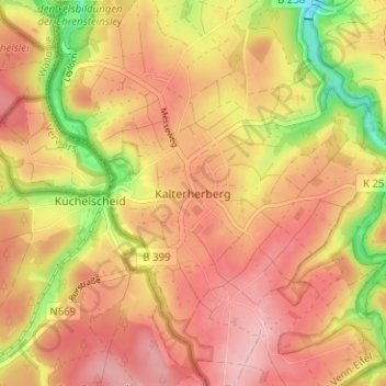
Name: Kalterherberg topographic map, elevation, terrain.
Average elevation: 547 m
Minimum elevation: 455 m
Maximum elevation: 600 m
Other topographic maps
Click on a map to view its topography, its elevation and its terrain.
Leykaul
Duitsland > Noordrijn-Westfalen > Städteregion Aachen > Monschau > Kalterherberg > Leykaul
Leykaul, Kalterherberg, Monschau, Städteregion Aachen, Noordrijn-Westfalen, 52156, Duitsland
Average elevation: 558 m