
Thank you for supporting this site ❤️
Make a donation
Make a donation
Corgo topographic map
Click on the map to display elevation.
Thank you for supporting this site ❤️
Make a donation
Make a donation
About this map
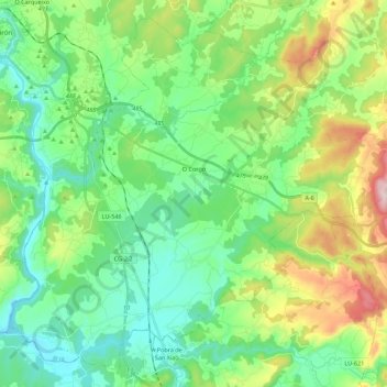
Name: Corgo topographic map, elevation, terrain.
Location: Corgo, Lugo, Galiza, Espanha (42.85815 -7.53617 43.00665 -7.31424)
Average elevation: 466 m
Minimum elevation: 344 m
Maximum elevation: 775 m
Thank you for supporting this site ❤️
Make a donation
Make a donation
Other topographic maps
Click on a map to view its topography, its elevation and its terrain.