
Vattinagulapally topographic map
Interactive map
Click on the map to display elevation.
About this map
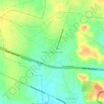
Name: Vattinagulapally topographic map, elevation, terrain.
Average elevation: 569 m
Minimum elevation: 544 m
Maximum elevation: 602 m
Other topographic maps
Click on a map to view its topography, its elevation and its terrain.
Manchirevula
India > Telangana > Gandipet mandal
Manchirevula, Gandipet mandal, Ranga Reddy District, Telangana, 500008, India
Average elevation: 531 m
Osman Sagar
India > Telangana > Gandipet mandal > Khanapur
Osman Sagar, Khanapur, Gandipet mandal, Rangareddy, Telangana, 500075, India
Average elevation: 546 m
Khajaguda Lake
India > Telangana > Gandipet mandal > Hyderabad
Khajaguda Lake, Manikonda, Serilingampalle mandal, Hyderabad, Gandipet mandal, Rangareddy, Telangana, India
Average elevation: 561 m
Khanapur
India > Telangana > Gandipet mandal
Khanapur, Gandipet mandal, Ranga Reddy District, Telangana, 500075, India
Average elevation: 555 m