
Schönanger topographic map
Interactive map
Click on the map to display elevation.
About this map
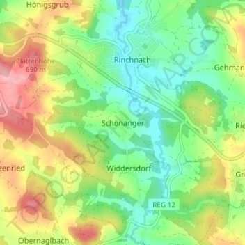
Name: Schönanger topographic map, elevation, terrain.
Average elevation: 612 m
Minimum elevation: 552 m
Maximum elevation: 705 m
Other topographic maps
Click on a map to view its topography, its elevation and its terrain.
Zwiesel
Duitsland > Beieren > Landkreis Regen
Zwiesel, Landkreis Regen, Beieren, 94227, Duitsland
Average elevation: 681 m