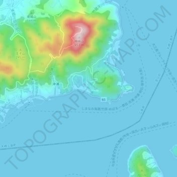
沖浦 (Okiura) topographic map
Interactive map
Click on the map to display elevation.
About this map
Name: 沖浦 (Okiura) topographic map, elevation, terrain.
Average elevation: 54 m
Minimum elevation: 0 m
Maximum elevation: 424 m

Click on the map to display elevation.
Name: 沖浦 (Okiura) topographic map, elevation, terrain.
Average elevation: 54 m
Minimum elevation: 0 m
Maximum elevation: 424 m