
Thank you for supporting this site ❤️
Make a donation
Make a donation
Bohol Island topographic map
Click on the map to display elevation.
Thank you for supporting this site ❤️
Make a donation
Make a donation
About this map
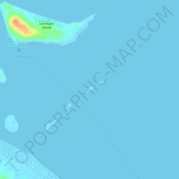
Name: Bohol Island topographic map, elevation, terrain.
Location: Bohol Island, Villareal, Samar, Eastern Visayas, Philippines (11.58606 124.91822 11.58707 124.91955)
Average elevation: 1 m
Minimum elevation: 0 m
Maximum elevation: 50 m
Thank you for supporting this site ❤️
Make a donation
Make a donation