
Thank you for supporting this site ❤️
Make a donation
Make a donation
Luanda Province topographic map
Click on the map to display elevation.
Thank you for supporting this site ❤️
Make a donation
Make a donation
About this map
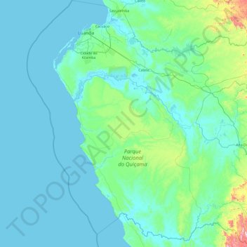
Name: Luanda Province topographic map, elevation, terrain.
Location: Luanda Province, Angola (-10.45624 12.78978 -8.58002 14.62167)
Average elevation: 86 m
Minimum elevation: -2 m
Maximum elevation: 1,170 m
Thank you for supporting this site ❤️
Make a donation
Make a donation
Other topographic maps
Click on a map to view its topography, its elevation and its terrain.