
จังหวัดนครปฐม topographic map
Interactive map
Click on the map to display elevation.
About this map
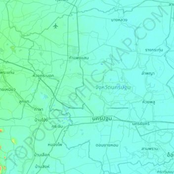
Name: จังหวัดนครปฐม topographic map, elevation, terrain.
Location: จังหวัดนครปฐม, Thaïlande (13.64914 99.80693 14.17913 100.33757)
Average elevation: 7 m
Minimum elevation: -4 m
Maximum elevation: 142 m
Other topographic maps
Click on a map to view its topography, its elevation and its terrain.
คลองโยง
Thaïlande > จังหวัดนครปฐม > คลองโยง
คลองโยง, ขุนแก้ว, จังหวัดนครปฐม, ึ73170, Thaïlande
Average elevation: 3 m