
サムットサーコーン topographic map
Interactive map
Click on the map to display elevation.
About this map
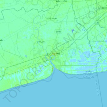
Name: サムットサーコーン topographic map, elevation, terrain.
Location: サムットサーコーン, ท่าจีน, サムットサーコーン県, タイ王国 (13.38978 100.11428 13.70978 100.43428)
Average elevation: 2 m
Minimum elevation: -16 m
Maximum elevation: 13 m