
Provincia de Celendín topographic map
Interactive map
Click on the map to display elevation.
About this map
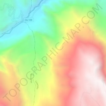
Name: Provincia de Celendín topographic map, elevation, terrain.
Location: Provincia de Celendín, Celendín, Cajamarca, Perú (-6.82018 -78.22365 -6.78018 -78.18365)
Average elevation: 2,300 m
Minimum elevation: 1,458 m
Maximum elevation: 3,136 m
Other topographic maps
Click on a map to view its topography, its elevation and its terrain.