
Thank you for supporting this site ❤️
Make a donation
Make a donation
Rottevalle topographic map
Click on the map to display elevation.
Thank you for supporting this site ❤️
Make a donation
Make a donation
About this map
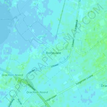
Name: Rottevalle topographic map, elevation, terrain.
Location: Rottevalle, Smallingerland, Frisia, Netherlands (53.13101 6.06290 53.15899 6.12427)
Average elevation: 2 m
Minimum elevation: -5 m
Maximum elevation: 7 m
Thank you for supporting this site ❤️
Make a donation
Make a donation
Other topographic maps
Click on a map to view its topography, its elevation and its terrain.