
Dawu County topographic map
Interactive map
Click on the map to display elevation.
About this map
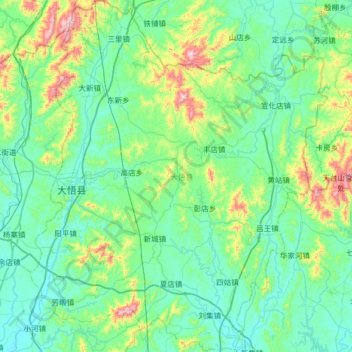
Name: Dawu County topographic map, elevation, terrain.
Location: Dawu County, Xiaogan, Hubei, China (31.30874 114.04452 31.85600 114.58830)
Average elevation: 175 m
Minimum elevation: 37 m
Maximum elevation: 843 m
Other topographic maps
Click on a map to view its topography, its elevation and its terrain.