
Thank you for supporting this site ❤️
Make a donation
Make a donation
Semera topographic map
Click on the map to display elevation.
Thank you for supporting this site ❤️
Make a donation
Make a donation
About this map
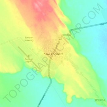
Name: Semera topographic map, elevation, terrain.
Location: Semera, Zone 1, Afar Region, 7240, Ethiopia (11.75231 40.96892 11.83231 41.04892)
Average elevation: 411 m
Minimum elevation: 377 m
Maximum elevation: 463 m
Thank you for supporting this site ❤️
Make a donation
Make a donation