
Thank you for supporting this site ❤️
Make a donation
Make a donation
Hancock County topographic map
Click on the map to display elevation.
Thank you for supporting this site ❤️
Make a donation
Make a donation
About this map
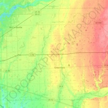
Name: Hancock County topographic map, elevation, terrain.
Location: Hancock County, Indiana, United States (39.69718 -85.95401 39.94582 -85.57593)
Average elevation: 270 m
Minimum elevation: 233 m
Maximum elevation: 314 m
Thank you for supporting this site ❤️
Make a donation
Make a donation
Other topographic maps
Click on a map to view its topography, its elevation and its terrain.