
Hardin County topographic map
Interactive map
Click on the map to display elevation.
About this map
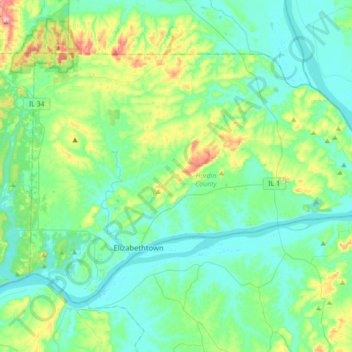
Name: Hardin County topographic map, elevation, terrain.
Location: Hardin County, Illinois, United States (37.40166 -88.41567 37.59982 -88.06257)
Average elevation: 139 m
Minimum elevation: 97 m
Maximum elevation: 270 m
Other topographic maps
Click on a map to view its topography, its elevation and its terrain.