
Thank you for supporting this site ❤️
Make a donation
Make a donation
Mandi topographic map
Click on the map to display elevation.
Thank you for supporting this site ❤️
Make a donation
Make a donation
About this map
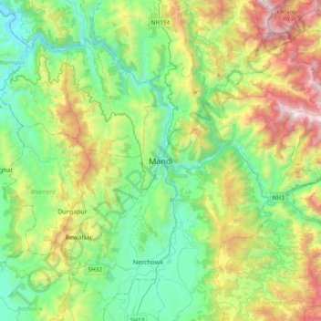
Name: Mandi topographic map, elevation, terrain.
Location: Mandi, Mandi District, Himachal Pradesh, 175001, India (31.54845 76.76938 31.86845 77.08938)
Average elevation: 1,273 m
Minimum elevation: 595 m
Maximum elevation: 2,851 m
Thank you for supporting this site ❤️
Make a donation
Make a donation
Other topographic maps
Click on a map to view its topography, its elevation and its terrain.