
Lac Lewis topographic map
Interactive map
Click on the map to display elevation.
About this map
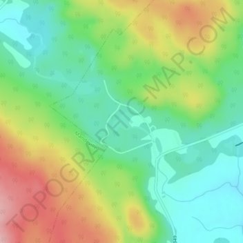
Name: Lac Lewis topographic map, elevation, terrain.
Average elevation: 230 m
Minimum elevation: 169 m
Maximum elevation: 323 m
Other topographic maps
Click on a map to view its topography, its elevation and its terrain.
Lac Lagacé
Canada > Québec > Saint-Didace
Lac Lagacé, Chemin du 9 Rang York, Saint-Didace, D'Autray, Lanaudière, Québec, Canada
Average elevation: 222 m