
Bangsil topographic map
Interactive map
Click on the map to display elevation.
About this map
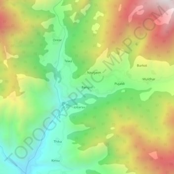
Name: Bangsil topographic map, elevation, terrain.
Location: Bangsil, Dhanaulti, Tehri Garhwal District, Uttarakhand, India (30.52635 78.16335 30.56635 78.20335)
Average elevation: 1,871 m
Minimum elevation: 1,294 m
Maximum elevation: 2,654 m