Geolocate

Prusice topographic map

Interactive map

Click on the map to display elevation.

About this map

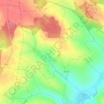
Name: Prusice topographic map, elevation, terrain.

Location: Prusice, okres Praha-východ, Central Bohemia, 281 63, Czechia (49.96341 14.85851 49.97751 14.89497)

Average elevation: 394 m

Minimum elevation: 350 m

Maximum elevation: 435 m

Other topographic maps

Click on a map to view its topography, its elevation and its terrain.

Kladno

Czechia > Central Bohemia

Kladno, okres Kladno, Central Bohemia, Czechia

Average elevation: 369 m

Srby u Tuchlovic

Czechia > Central Bohemia

Srby u Tuchlovic, Tuchlovice, okres Kladno, Central Bohemia, Czechia

Average elevation: 401 m

Velim

Czechia > Central Bohemia > Velim

Velim, okres Kolín, Central Bohemia, 281 01, Czechia

Average elevation: 215 m

Kanina

Czechia > Central Bohemia > Kanina

Kanina, okres Mělník, Central Bohemia, Czechia

Average elevation: 322 m

CHKO Křivoklátsko

Czechia > Central Bohemia > Nezabudice

CHKO Křivoklátsko, 201, Nezabudice, okres Rakovník, Středočeský kraj, Central Bohemia, 27023, Czechia

Average elevation: 400 m