
Thank you for supporting this site ❤️
Make a donation
Make a donation
Maui County topographic map
Click on the map to display elevation.
Thank you for supporting this site ❤️
Make a donation
Make a donation
Maui County
At its lowest, near the ocean, the National Park has a tropical rainforest climate bordering a tropical monsoon climate. However, as altitudes progresses the climate becomes oceanic/Mediterranean, reaching, at the very top of Haleakalā, an alpine climate.
Thank you for supporting this site ❤️
Make a donation
Make a donation
About this map
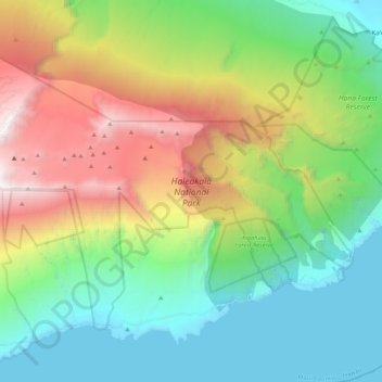
Name: Maui County topographic map, elevation, terrain.
Average elevation: 949 m
Minimum elevation: 0 m
Maximum elevation: 2,894 m
Thank you for supporting this site ❤️
Make a donation
Make a donation
Other topographic maps
Click on a map to view its topography, its elevation and its terrain.