
Thank you for supporting this site ❤️
Make a donation
Make a donation
Vernon topographic map
Click on the map to display elevation.
Thank you for supporting this site ❤️
Make a donation
Make a donation
About this map
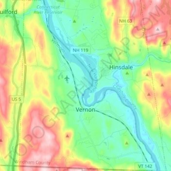
Name: Vernon topographic map, elevation, terrain.
Location: Vernon, Windham County, Vermont, 05354, United States (42.72696 -72.56535 42.82418 -72.45845)
Average elevation: 164 m
Minimum elevation: 54 m
Maximum elevation: 359 m
Thank you for supporting this site ❤️
Make a donation
Make a donation
Other topographic maps
Click on a map to view its topography, its elevation and its terrain.
Thank you for supporting this site ❤️
Make a donation
Make a donation
Thank you for supporting this site ❤️
Make a donation
Make a donation