
Hacienda Huarca topographic map
Interactive map
Click on the map to display elevation.
About this map
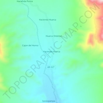
Name: Hacienda Huarca topographic map, elevation, terrain.
Location: Hacienda Huarca, Caravelí, Arequipa, Perú (-15.83937 -73.33408 -15.79937 -73.29408)
Average elevation: 1,680 m
Minimum elevation: 1,583 m
Maximum elevation: 2,007 m
Other topographic maps
Click on a map to view its topography, its elevation and its terrain.