
Thank you for supporting this site ❤️
Make a donation
Make a donation
Toms River topographic map
Click on the map to display elevation.
Thank you for supporting this site ❤️
Make a donation
Make a donation
About this map
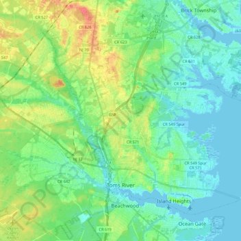
Name: Toms River topographic map, elevation, terrain.
Location: Toms River, Ocean County, New Jersey, United States (39.93300 -74.27067 40.05961 -74.05858)
Average elevation: 14 m
Minimum elevation: -3 m
Maximum elevation: 46 m
Thank you for supporting this site ❤️
Make a donation
Make a donation