
Rutovu topographic map
Interactive map
Click on the map to display elevation.
About this map
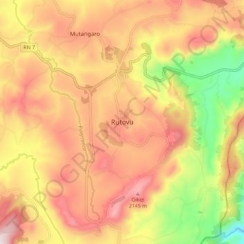
Name: Rutovu topographic map, elevation, terrain.
Location: Rutovu, Bururi, Burundi (-3.92105 29.80735 -3.84105 29.88735)
Average elevation: 1,929 m
Minimum elevation: 1,548 m
Maximum elevation: 2,218 m