
Munhyeon-dong topographic map
Interactive map
Click on the map to display elevation.
About this map
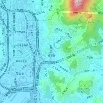
Name: Munhyeon-dong topographic map, elevation, terrain.
Location: Munhyeon-dong, Nam-gu, Busan, South Korea (35.12677 129.06310 35.15261 129.08424)
Average elevation: 50 m
Minimum elevation: 0 m
Maximum elevation: 352 m