
Thank you for supporting this site ❤️
Make a donation
Make a donation
Tomahawk topographic map
Click on the map to display elevation.
Thank you for supporting this site ❤️
Make a donation
Make a donation
About this map
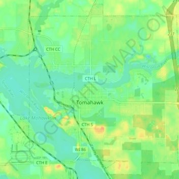
Name: Tomahawk topographic map, elevation, terrain.
Location: Tomahawk, Lincoln County, Wisconsin, United States (45.44980 -89.76236 45.49980 -89.68790)
Average elevation: 443 m
Minimum elevation: 431 m
Maximum elevation: 460 m
Thank you for supporting this site ❤️
Make a donation
Make a donation
Other topographic maps
Click on a map to view its topography, its elevation and its terrain.