
Madna topographic map
Interactive map
Click on the map to display elevation.
About this map
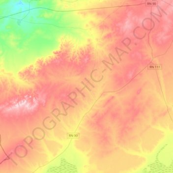
Name: Madna topographic map, elevation, terrain.
Location: Madna, Aïn Kermes District, Tiaret, Algeria (34.61586 0.69299 34.87884 1.07301)
Average elevation: 1,041 m
Minimum elevation: 877 m
Maximum elevation: 1,176 m