
Elburs-Gebirge topographic map
Interactive map
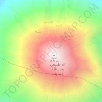
Click on the map to display elevation.
About this map
Name: Elburs-Gebirge topographic map, elevation, terrain.
Average elevation: 4,934 m
Minimum elevation: 4,249 m
Maximum elevation: 5,595 m
Other topographic maps
Click on a map to view its topography, its elevation and its terrain.
Damāvand
Iran > Mazandaran > لاریجان سفلی
Damāvand, لاریجان سفلی, بخش لاریجان, شهرستان آمل, Mazandaran, Iran
Average elevation: 4,946 m